

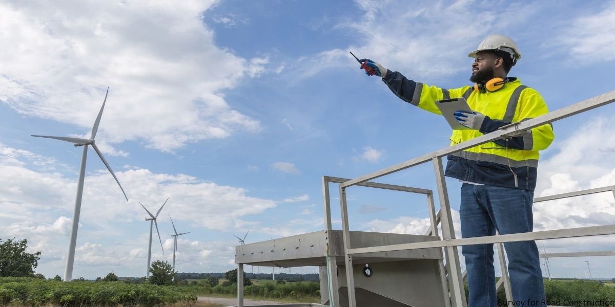
A survey for road construction is the process of collecting land, elevation, soil, and alignment data before building roads or highways. It helps engineers design safe, durable, and cost-effective transportation infrastructure.
Road surveying is one of the most important stages in civil engineering projects. Without accurate survey data, roads may face:
- Drainage failure
- Incorrect alignment
- Pavement cracking
- Safety hazards
- Legal land disputes
- Increased construction costs
Modern road construction surveys combine traditional fieldwork with advanced technologies such as GPS surveying, drone mapping, GIS systems, LiDAR scanning, and total stations.
Whether the project involves a rural road, expressway, industrial roadway, or national highway, surveying ensures the construction process starts on accurate technical foundations.
What Is a Survey for Road Construction?
A survey for road construction is an engineering process used to measure terrain, boundaries, elevations, and existing site conditions before road development begins.
Surveyors gather essential information that helps engineers:
- Select the best route alignment
- Design drainage systems
- Calculate earthwork quantities
- Identify utility conflicts
- Plan pavement structures
- Maintain construction accuracy
This process supports every phase of highway engineering, from planning to construction staking.
Why Road Construction Surveys Are Important
Road surveys directly impact project quality, safety, and budget control.
Main Benefits of Road Surveying
| Benefit | Importance |
| Accurate roadway alignment | Reduces design mistakes |
| Elevation survey data | Improves drainage planning |
| Soil investigation | Prevents pavement failure |
| Utility mapping | Avoids underground damage |
| Earthwork estimation | Controls project costs |
| Right-of-way verification | Prevents legal issues |
For example, poor contour mapping can cause water accumulation on highways, leading to potholes and road surface deterioration.
Types of Surveys Used in Road Construction
Different survey methods are used during various stages of highway projects.
Reconnaissance Survey
A reconnaissance survey is the first stage of road surveying.
Survey teams inspect:
- Terrain conditions
- Existing infrastructure
- Rivers and drainage channels
- Hills and valleys
- Environmental obstacles
The purpose is to identify possible roadway corridors and evaluate feasibility.
Preliminary Survey
A preliminary survey collects detailed engineering data for route selection.
This stage includes:
- Topographic mapping
- Soil testing
- Cross-section survey
- Traffic studies
- Drainage analysis
It helps engineers determine the most practical and economical alignment.
Location Survey
The location survey finalizes the selected route on the ground.
Surveyors establish:
- Benchmark points
- Horizontal alignment
- Vertical alignment
- Road centerlines
- Curves and gradients
This step is critical for construction accuracy.
Topographic Survey
A topographic survey maps both natural and man-made features.
It records:
- Contours
- Slopes
- Buildings
- Trees
- Utilities
- Water bodies
- Existing roads
Topographic surveys are essential for drainage engineering and pavement design.
Construction Layout Survey
Construction layout surveys are performed during road construction.
Surveyors mark:
- Excavation limits
- Road edges
- Pavement widths
- Bridge locations
- Culvert positions
This process guides construction machinery and contractors.
Step-by-Step Road Construction Survey Process
Understanding the survey workflow helps contractors, engineers, and students understand how highway projects are developed.
Step 1: Office Study
Engineers review:
- Satellite imagery
- GIS mapping
- Land records
- Existing road data
- Environmental reports
Software such as ArcGIS and AutoCAD Civil 3D is commonly used.
Step 2: Field Reconnaissance
Survey teams physically inspect the proposed area.
They identify:
- Flood-prone zones
- Utility conflicts
- Terrain challenges
- Soil conditions
- Environmental restrictions
Step 3: Control Point Establishment
Benchmark points are installed to maintain survey accuracy throughout the project.
These reference points support:
- Elevation control
- Alignment consistency
- Earthwork calculations
Step 4: Data Collection
Surveyors collect detailed field data using:
- Trimble GPS systems
- Leica Geosystems equipment
- Total stations
- DJI drones
- LiDAR scanners
This stage includes:
- Contour mapping
- Utility mapping
- Cross-section analysis
- Drainage survey
Step 5: Alignment Design
Engineers design:
- Horizontal alignment
- Vertical alignment
- Pavement layers
- Drainage systems
Good alignment reduces long-term maintenance costs and improves traffic safety.
Step 6: Construction Staking
Surveyors mark construction reference points on-site to guide contractors during excavation and paving.
GPS Surveying in Highway Construction
GPS road surveying is widely used in modern highway engineering projects.
Advantages of GPS Surveying
- Faster data collection
- Real-time positioning
- High accuracy over long distances
- Reduced labor requirements
- Efficient corridor mapping
GPS systems are especially useful for:
- Highway route surveys
- Rural road projects
- Smart city infrastructure
- Earthwork estimation
Modern RTK GPS systems can provide centimeter-level accuracy.
Drone Mapping for Road Surveys
Drone surveying has transformed the road construction industry.
Using UAV mapping, engineers can quickly gather aerial data for:
- Topographic surveys
- Corridor mapping
- Progress monitoring
- Volume calculations
- Site visualization
Benefits of Drone Surveys
| Benefit | Advantage |
| Faster fieldwork | Saves project time |
| Improved safety | Reduces manual site exposure |
| Better visualization | Supports route planning |
| Reduced cost | Minimizes labor requirements |
Drone mapping is increasingly common in countries investing heavily in infrastructure development, including the UAE, USA, UK, and Canada.
Total Station vs GPS Surveying
Both technologies are important in road construction surveys.
| Feature | Total Station | GPS Surveying |
| Accuracy | Very high | High |
| Best use | Precise layout work | Large-area mapping |
| Speed | Moderate | Fast |
| Terrain suitability | Urban projects | Open corridors |
| Cost | Medium | Medium to High |
Many survey engineering services combine both methods for maximum accuracy.
Geotechnical Survey and Soil Testing
Road performance depends heavily on soil conditions.
A geotechnical survey evaluates whether the soil can support traffic loads and pavement structures.
Common Soil Tests
| Test | Purpose |
| CBR Test | Pavement design |
| Compaction Test | Soil density |
| Grain Size Analysis | Soil classification |
| Atterberg Limits | Soil plasticity |
Poor soil investigation can lead to:
- Pavement cracking
- Road settlement
- Drainage issues
- Expensive repairs
Drainage Planning in Road Surveying
Drainage engineering is a critical part of road design.
Improper drainage causes:
- Water accumulation
- Pavement weakening
- Surface erosion
- Flooding problems
Common Drainage Components
- Side drains
- Culverts
- Stormwater channels
- Cross-drainage structures
Topographic mapping and elevation surveys help engineers design effective drainage systems.
Road Survey Equipment Used by Professionals
Modern road survey companies use advanced tools to improve accuracy and efficiency.
Essential Survey Instruments
| Equipment | Purpose |
| GPS Receiver | Position measurement |
| Total Station | Distance and angle measurement |
| Dumpy Level | Elevation control |
| Drone/UAV | Aerial mapping |
| LiDAR Scanner | 3D terrain scanning |
| GIS Software | Mapping and analysis |
Popular brands include:
- Leica Geosystems
- Trimble GPS
- Topcon
- Bentley Systems
Common Problems During Road Surveys
Even experienced highway survey consultants face technical and environmental challenges.
Frequent Issues
Poor GPS Signals
Dense urban environments and mountainous terrain may reduce GPS accuracy.
Incomplete Utility Mapping
Underground pipelines and cables can create construction risks.
Incorrect Elevation Data
This often leads to drainage failure and unsafe road gradients.
Land Ownership Disputes
Right-of-way acquisition issues may delay projects.
Weather Delays
Rain, fog, and extreme temperatures affect fieldwork accuracy.
Road Survey Cost Factors
Many people search for “road survey cost per kilometer” or “highway survey services near me.”
Survey pricing depends on several factors.
Main Cost Factors
| Factor | Impact |
| Project size | Larger projects cost more |
| Terrain complexity | Mountain areas require extra work |
| Survey technology | LiDAR and drones increase cost |
| Soil testing requirements | Additional geotechnical expenses |
| Regulatory approvals | Permit-related costs |
Typical Survey Categories
- Land survey
- Topographic survey
- GPS corridor survey
- Drone mapping survey
- Full highway engineering survey
Large infrastructure projects may also require GIS integration and environmental analysis.
How to Choose the Right Road Survey Company
Hiring experienced professionals improves project quality and reduces costly errors.
What to Look For
Highway Engineering Experience
Choose firms with proven infrastructure expertise.
Modern Survey Equipment
Look for companies using:
- GPS systems
- Total stations
- Drone mapping
- LiDAR scanning
Licensed Professionals
Verify compliance certifications and approvals.
GIS and CAD Skills
Advanced roadway projects require digital mapping expertise.
Popular Search Queries
- road survey company in Dubai
- topographic survey firms in Lahore
- highway survey services in Texas
- construction surveyors near me
- highway survey consultant near me
Best Practices for Accurate Road Surveys
Road Survey Checklist
- Verify benchmark points regularly
- Use calibrated survey instruments
- Combine GPS and total station measurements
- Conduct proper drainage analysis
- Review utility mapping carefully
- Maintain digital backups
- Follow AASHTO and ISO standards
- Double-check cross-section data
These practices improve long-term road durability and construction accuracy.
Future Trends in Highway Surveying
Road surveying technology continues to evolve rapidly.
Emerging Innovations
AI-Assisted Survey Analysis
Artificial intelligence helps optimize route alignment and terrain analysis.
LiDAR Digital Twin Modeling
LiDAR scanning creates highly accurate 3D terrain models.
Autonomous Survey Drones
Automated UAV mapping reduces labor and survey time.
Smart GIS Monitoring
Modern smart cities increasingly rely on GIS systems for infrastructure management.
These technologies are reshaping the future of civil engineering and transportation planning.
FAQs
What is a survey for road construction?
A survey for road construction measures terrain, elevations, soil conditions, and boundaries before building roads or highways.
Why is surveying important in highway construction?
Surveying improves alignment accuracy, drainage planning, safety, and construction efficiency while reducing costly design errors.
What equipment is used in road surveys?
Common equipment includes GPS receivers, total stations, drones, LiDAR scanners, GIS software, and dumpy levels.
What is the difference between topographic and route surveys?
Topographic surveys map land features and elevations, while route surveys focus on selecting and designing the roadway alignment.
Can drones be used for road construction surveys?
Yes. Drone mapping is widely used for aerial surveys, corridor mapping, and earthwork calculations.
How long does a road survey take?
Small road projects may take a few days, while major highway corridor surveys can take weeks or months.
Which survey comes first in road construction?
The reconnaissance survey is usually the first stage before preliminary and location surveys.
What causes road survey errors?
Common causes include poor GPS signals, inaccurate elevation data, incomplete utility mapping, and weather-related issues.
Conclusion
A survey for road construction is the foundation of every successful roadway project. Accurate surveying improves safety, supports effective drainage engineering, reduces construction costs, and ensures proper roadway alignment.
Modern highway surveying combines GPS systems, drone mapping, GIS technology, LiDAR scanning, and geotechnical analysis to deliver highly accurate results for infrastructure development.
Whether you are a contractor, civil engineering student, infrastructure consultant, or government agency, understanding road surveying methods helps improve project planning, reduce risks, and build safer roads for the future.